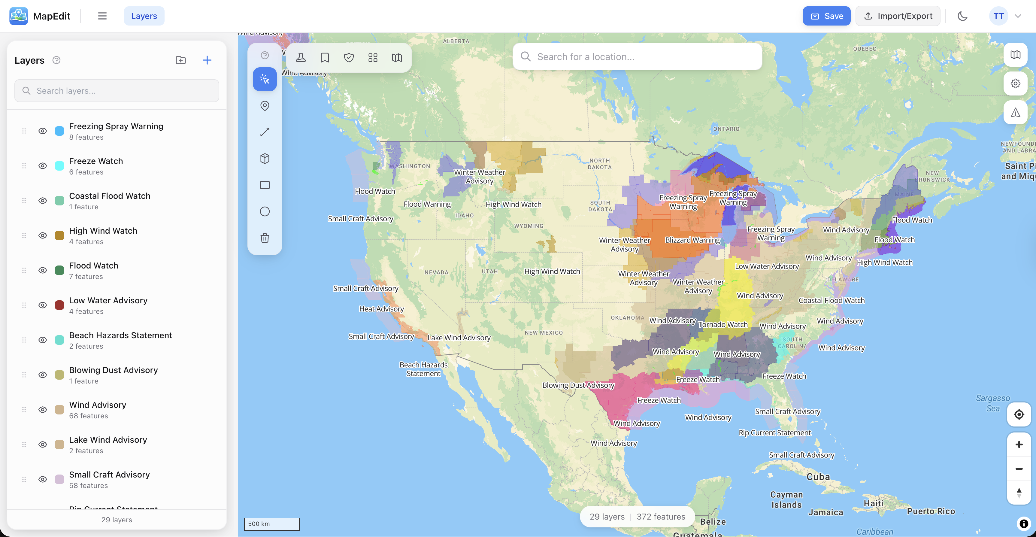
The map editor you
actually want to use
Import, analyze, style, and share maps with professional GIS tools — entirely in your browser.
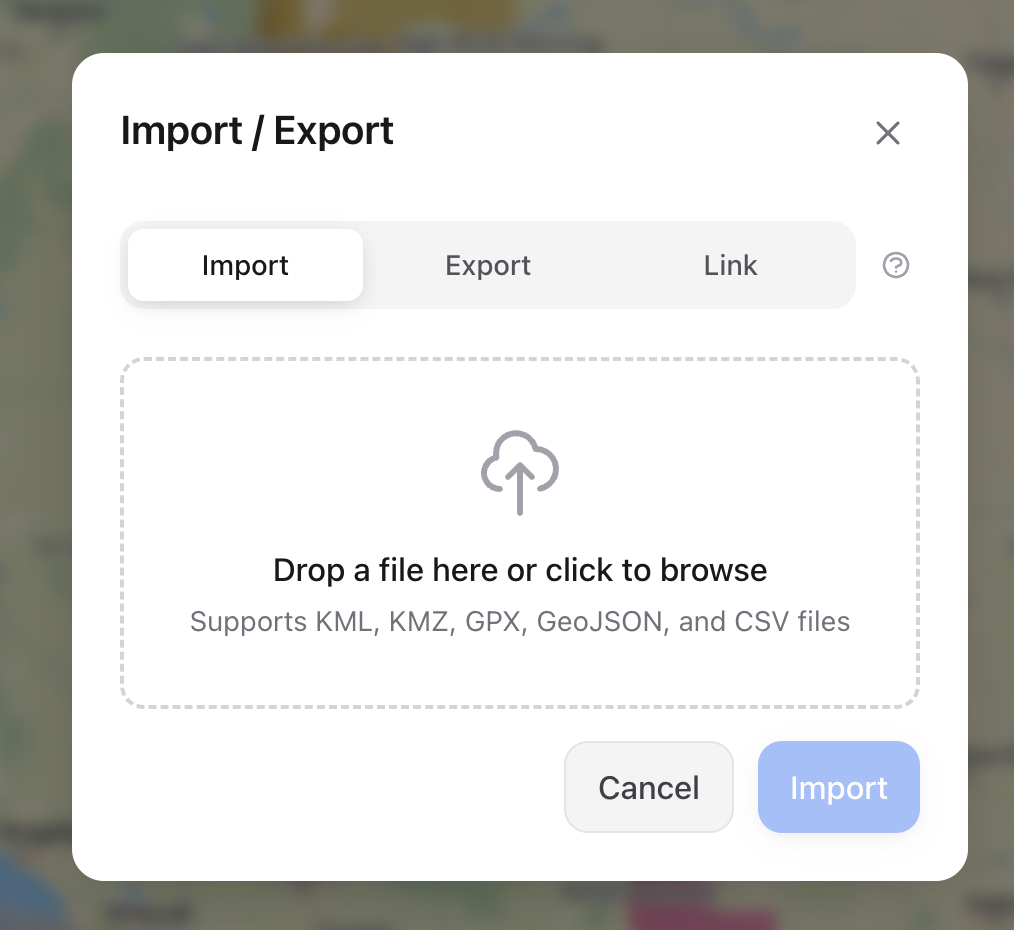
Bring your data, any format
Drag in KML from Google Earth, GeoJSON, Shapefiles, GPX tracks, or a CSV. MapEdit auto-detects coordinate columns and preserves styles from KML files. Need live data? Point it at a URL and it refreshes on a schedule.
- KML, KMZ, GeoJSON, Shapefile, GPX, CSV, TopoJSON
- Live data feeds with auto-refresh
- Style preservation from KML
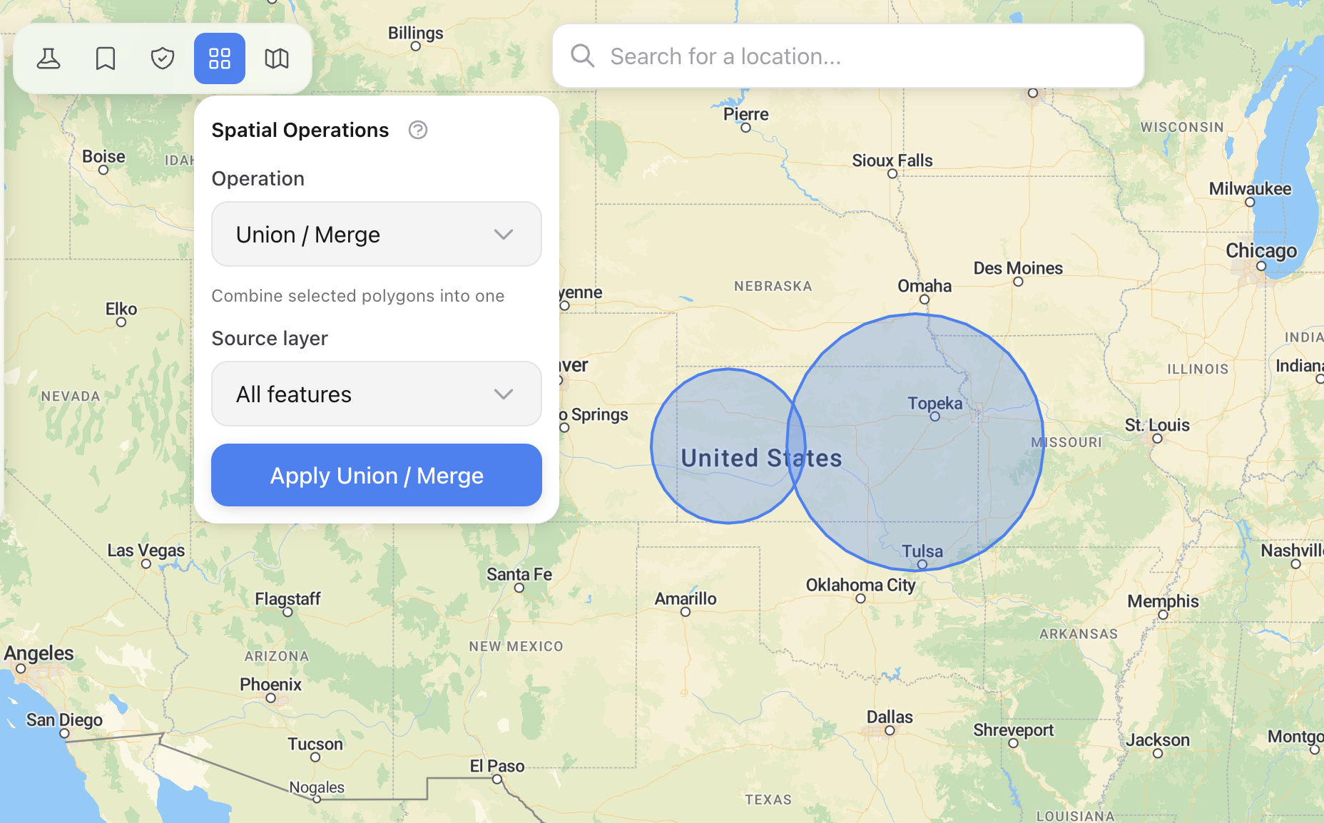
Real GIS, in the browser
Run spatial operations that normally require desktop software. Union, intersect, clip, dissolve, buffer, simplify — all powered by Turf.js. Color features by property values with automatic legend generation.
- Spatial ops: union, intersect, clip, buffer, dissolve
- Data-driven styling with auto-legends
- Measurement, routing, and analysis tools
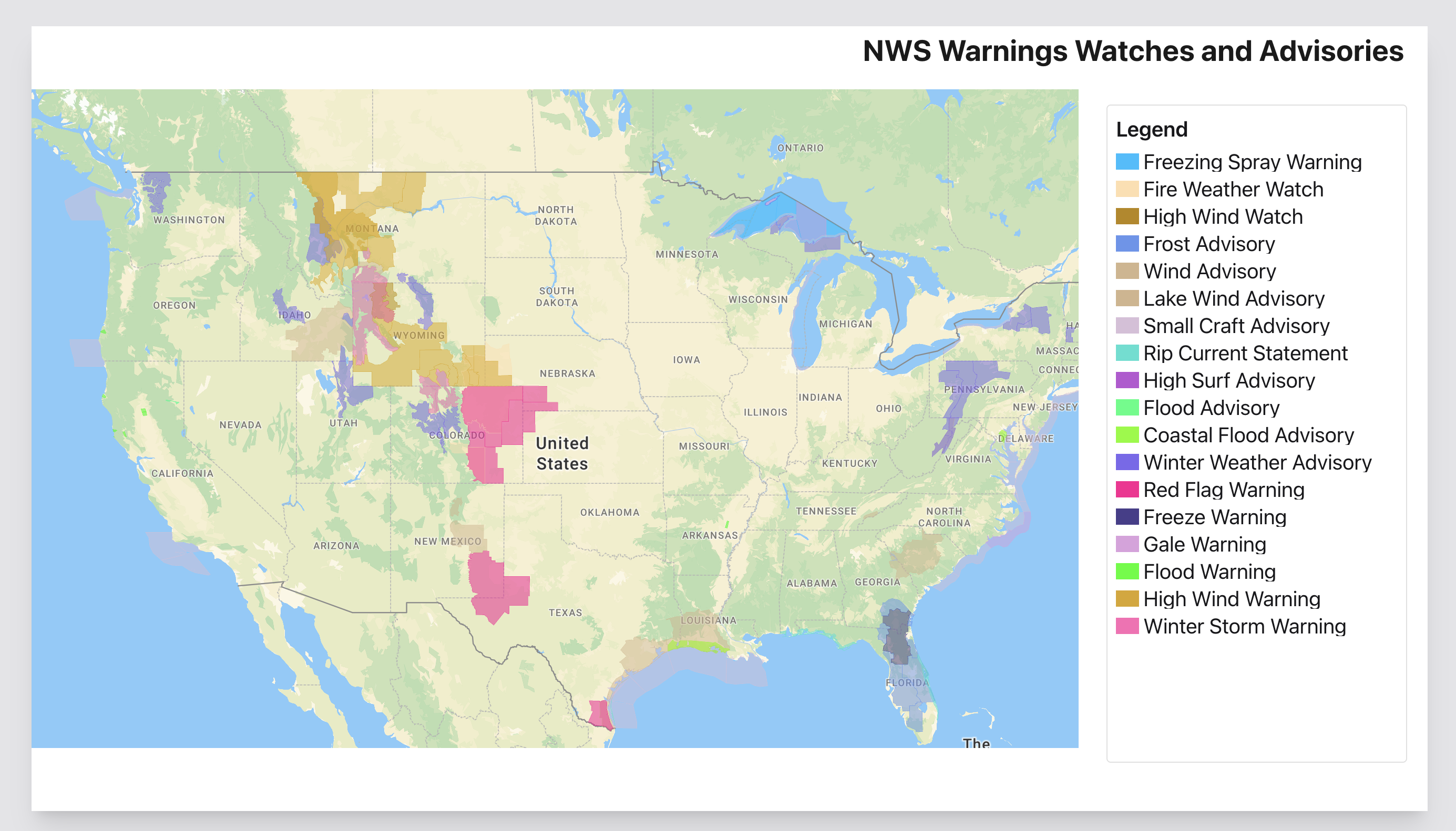
Print-ready in minutes
The Map Composer gives you a canvas with draggable elements — title, legend, scale bar, north arrow. Pick a template or build from scratch. Export as PDF or PNG at up to 300 DPI.
- Drag-and-drop layout designer
- PDF and PNG at 72, 150, or 300 DPI
- Pre-built templates for common layouts
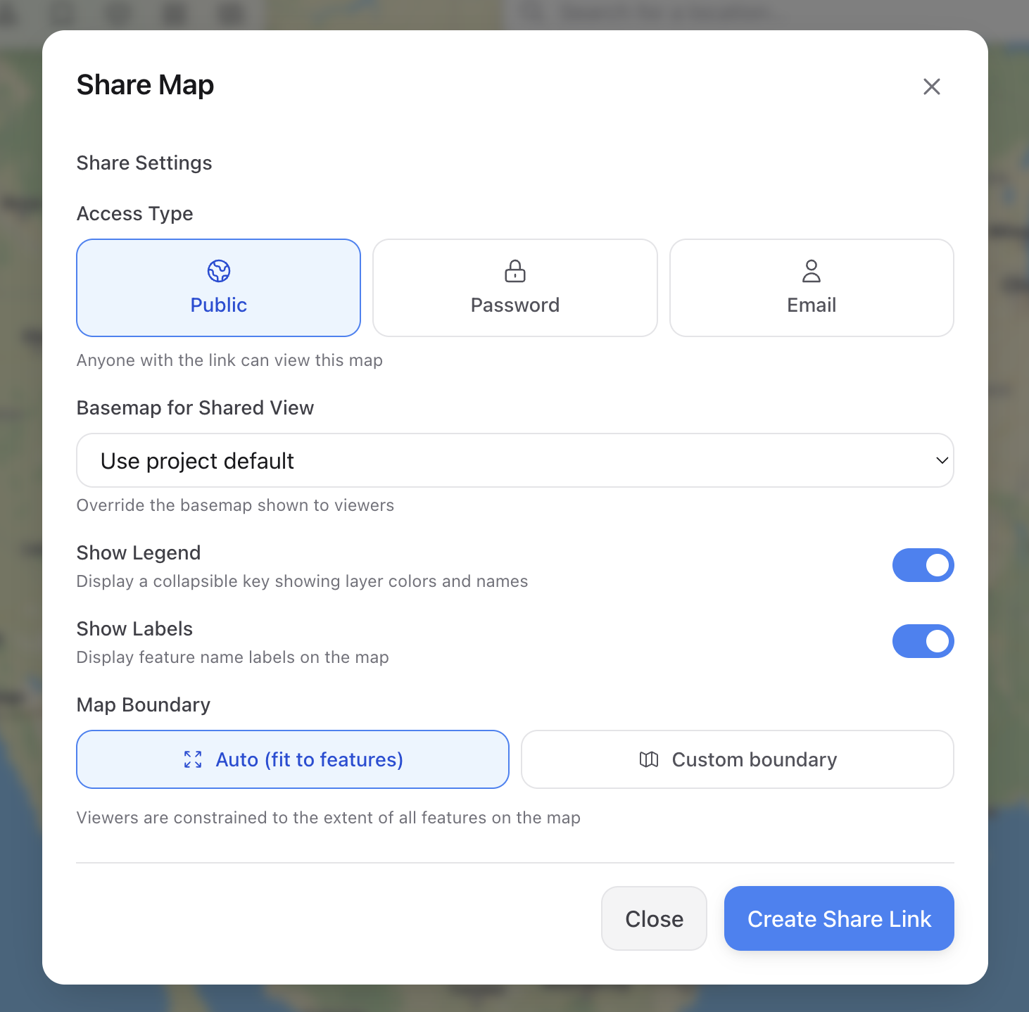
Share on your terms
Generate a link that's public, email-restricted, or password-protected. Optionally constrain the viewport, set an expiration date, and track how many people view it.
- Public, email, or password access
- Expiration dates and view tracking
- Custom viewport bounds
How it stacks up
Desktop-grade features, browser-based simplicity, zero cost.
| MapEdit | Google My Maps | Felt | QGIS | ArcGIS Online | |
|---|---|---|---|---|---|
| Free to use | Limited | ||||
| No install required | |||||
| Multiple map engines | |||||
| Spatial analysis | Limited | Paid | |||
| Data-driven styling | |||||
| Print composer / PDF | Paid | ||||
| Live data feeds | Paid | WFS/WMS | |||
| Routing & directions | Plugin | Paid | |||
| Password-protected sharing | |||||
| KML/KMZ import with styles | |||||
| Shapefile import | Paid | ||||
| Attribute table editing | |||||
| Real-time collaboration |